
I started this post last summer after completing a 10-day hike of about 80% of the Offa's Dyke Path, a U.K. National Trail that weaves northward along the border that separates Wales and England, from the estuary of the River Severn in the south and the Irish Sea in the north. I'm not sure why I never got around to completing the post and publishing it, but it may have had something to do with a few traumatic experiences along the way. Among other things, I encountered more aggressive bulls than I had in previous walking trips in the U.K, and on the second day out, I came very close to being severely injured (or worse) when I was charged by a very mean and dangerous bull. For all of you walkers through remote agricultural country, allow me to humbly offer a simple but hard-learned lesson: Always take trekking poles; they may one day save your life.
That said, I will leave the traumatic memories now and put up some photos of what was otherwise a wonderful walk of all but the last 20% of the 177-mile Offa's Dyke Path. I decided not to attempt the last couple of days because a significant portion of the last section was on a high ridge of the Clwydian Range, the forecasted weather conditions for that area were horrendous, and I was walking alone. Prudence dictated that I save the last section for another day.

Map of Offa's Dyke Path
Day 1: Chepstow to Redbrook
Stone at Sedbury Cliffs (on the Severn) Marking Beginning of Offa's Dyke Path

Early Stage of Path

Early Stage of Path

Chepstow Castle,
construction of which began in 1067,
is the oldest surviving post-Roman
stone fortification in the United Kingdom.
construction of which began in 1067,
is the oldest surviving post-Roman
stone fortification in the United Kingdom.

Sunday day-walkers as I leave Chepstow

Tinturn Abbey
(made famous by William Wordsworth's "Lines Composed a Few Miles
Above Tintern Abbey, On Revisiting the Banks of the Wye During a Tour. July 13, 1798,"
a portion of which is set forth below)
(made famous by William Wordsworth's "Lines Composed a Few Miles
Above Tintern Abbey, On Revisiting the Banks of the Wye During a Tour. July 13, 1798,"
a portion of which is set forth below)
. . . I have felt
A presence that disturbs me with the joy
Of elevated thoughts; a sense sublime
Of something far more deeply interfused,
Whose dwelling is the light of setting suns,
And the round ocean and the living air,
And the blue sky, and in the mind of man:
A motion and a spirit, that impels
All thinking things, all objects of all thought,
And rolls through all things. Therefore am I still
A lover of the meadows and the woods
And mountains; and of all that we behold
From this green earth; of all the mighty world
Of eye, and ear, — both what they half create,
And what perceive; well pleased to recognize
In nature and language of the sense
The anchor of my purest thoughts, the nurse,
The guide, the guardian of my heart, and soul
Of all my moral being.

Refined Section of Path Near Tinturn Abbey

Path Along River Wye

Winding Through Wildflower Meadow Along River Wye

Bigsweir Bridge Over the River Wye

Descending Into Village of Redbrook

Accommodations for Evening in Redbrook
 Farmer's Track Bordered by Foxglove and Other Wildflowers
 Thirteenth Century Gate House Over the River Monnow in Monmouth
(the town in which the future king Henry V was born in 1387)
 Sometimes there's a bridge, sometimes not . . .
 Sometimes the path is barely visible, such as when crossing a mowed hay field . . .
 . . . or crossing a barely trodden wildflower meadow.
 A wonderful old church that
always makes tea and biscuits available to walkers
 Country lane with Black Mountains in distance
(will soon be walking across that ridge from left to right)
 Ruins of White Castle in Monmouthshire, Wales
 Passing through wildflower meadow
(path on extreme right) toward the Black Mountains
 St. Cadoc's Church (13th Century) in LLangattock-Lingoed,
accross from Old Rectory B&B, where I spent the night


 Concrete pillars like this one are called "trig points."
They were used historically for measurement and navigational
purposes, and are frequently seen by walkers in the British countryside.


 A few portions of the ridge path have been reinforced
with stones to protect walkers from sinking in the bogs that permeate these moors.
 The higher elevations of the ridge suggest a lunar landscape.
 Finally, I begin the long descent from the ridge . . .
 . . . encountering wild Welsh ponies along the way . . .
 . . . passing through welcoming meadows and woodlands . . .
 . . . to the charming village of Hay-on-Wye, renowned for it fine small bookshops.
Stay tuned. More to come on the Offa's Dyke walk.
Day 2: Redbrook to White Castle


(the town in which the future king Henry V was born in 1387)


always makes tea and biscuits available to walkers

(will soon be walking across that ridge from left to right)

Day 3: White Castle to Longtown

(path on extreme right) toward the Black Mountains

accross from Old Rectory B&B, where I spent the night

Looking back as I begin walk up toward ridge of mountains

Had lunch on top of this little knoll as I climbed up to the ridge

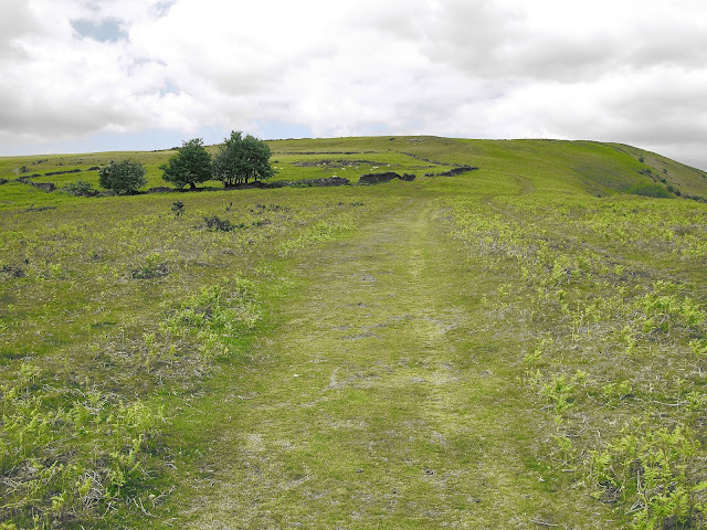
Note how terrain changes into moorland
as I continue toward the upper ridges. Also
note the remains of an ancient circular stone fort in the distance.

With more elevation, one can see the stark
difference between rather barren vegetation of the higher elevations
and the rich, fertile fields and pastures in the distant valley.

This view, looking backward from the direction I'm walking,
gives a sense of how much elevation I've gained since beginning
the day near the distant horizon.

They were used historically for measurement and navigational
purposes, and are frequently seen by walkers in the British countryside.

Path Through Moorland on Top Ridge of the Black Mountains

This image shows the variety of terrain in the Black Mountains of Wales — moorland in the foreground, a valley of fertile fields below, and a colorless rocky moonscape in the distance.

In the late afternoon of my first day in the Black Mountains, I took the only
available path down (left foreground) to search for my pub accommodations in the valley below.

My accommodations in Longtown — The Crown pub and b&b
Day 4: Longtown to Hay-on-Wye

Climbing back up to the ridge path the next
morning, I encountered some other fellwalkers out for the day.

After soon reconnecting with the Offa's Dyke Path,
I came upon this cairn which has been constructed stone by stone by walkers
passing this way. The tiny stone on top was my contribution for the day.

with stones to protect walkers from sinking in the bogs that permeate these moors.


Stay tuned. More to come on the Offa's Dyke walk.


