Milecastle 39 of Hadrian's Wall
Hadrian's Wall formed the north-west frontier of the Roman empire for most of the period AD122-410. The empire's frontiers extended over 5,000 km from the Atlantic coast of Britain through Europe, the Middle East and across North Africa to the Atlantic.
The site's outstanding universal value to humanity is recognized under the World Heritage Convention, 1972.Inscription on UNESCO Plaque at Segedunum
Eight days ago, I completed my 85-mile walk of the Hadrian's Wall Path, which stretches westward from Wallsend (just outside Newcastle on Tyne) to Bowness on Solway. Now part of the United Kingdom's incomparable national trail system, the path follows the ruins of the magnificent wall constructed by the Romans between AD 122 and 128 under the direction and guidance of Emperor Hadrian, who is remembered historically as one of "the five good emperors."
The Romans occupied Britannia in AD 43 and spent many years thereafter trying to subjugate the local tribes. On the whole, they were eminently successful; indeed, to some extent, many of the southern tribes eventually grew comfortable with the civil order and new infrastructure that came with Roman life. The northern tribes, however, known collectively as the Caledones and living in the area that is now Scotland, remained steadfastly recalcitrant and continued to resist Roman occupation at every opportunity. At the same time, mounting obligations in other parts of the Roman Empire were placing new burdens on both the treasury and the manpower of the empire. Thus, rather than remain in perennial conflict with the Caledones, the Romans decided to formally establish a northern frontier to their empire and to fortify that boundary as a means of separating the "lawless" northern tribes from the conquered and "law-abiding" southern tribes.
It was against this backdrop that Hadrian ordered the construction of the wall in AD 122. Much of the wall has been destroyed over the centuries by subsequent military conflicts, vandalism, scavenging, and weather. What remains, however, is magnificent, which is why UNESCO, in 1987, added the wall to its list of World Heritage Sites, placing the wall in the company of Petra, Angkor Wat, Machu Picchu, the Taj Mahal, and the Great Wall of China. Moreover, as indicated above, a walking path parallel to the wall was formally established and made part of the UK's national trail network in 2003.
I was honored to be joined on the walk by my two great friends — Robert, author of The Solitary Walker, who joined me for four days of the walk, and Dominic, author of Made Out of Words, who joined us for a couple of those days. Meeting these guys and enjoying their fine, cheerful, and edifying company was, without question, the highlight of the entire trip for me. For what it's worth, there was not a scintilla of difference between the friends I encountered personally and the initial impressions I had drawn of them from their respective blogs. Authentic, intelligent, adventurous, morally courageous, and good humored — these are the words that best describe the two guys who tramped with me through the best sections of the Hadrian's Wall path.
More about Robert and Dominic to come, so let's begin.
Day 1: Wallsend to Wylam
The path began inauspiciously at Wallsend near the foundation (photo below) of the ancient Roman fort of Segedunum, which is located in a largely industrial area.
Soon after leaving Segedunnum, however, the path took on its own kind of beauty, with magnificent patches of rosebay willowherb juxtaposed against the blue fences that offered visual protection from some of the modern developments.
The initial four or five miles of the path is an asphalt walking/cycling track that runs alongside the River Tyne. At one point, however, the path diverted through some lovely parkland . . .
. . . before returning to the asphalt track along the river. In the distance, I could see the city of Newcastle . . .
After leaving Newcastle, I reached the pleasant surroundings of the Tyne Riverside Country Park and and followed a riparian path that catered to equestrians and cyclists, as well as walkers.
After a few miles, the path turned away from the river, proceeded through some pleasant communities . . .
. . . and turned down the Wylam Waggonway. . .
. . . past the childhood cottage of George Stephenson, inventor of first steam locomotive for railroads . . .
. . . to the village of Wylam, where I spent the first evening.
Day 2: Wylam to Wall
After a brief walk to from Wylam to Heddon-on-the-Wall, I discovered the first significant portion of Hadrian's Wall.
After a brief walk to from Wylam to Heddon-on-the-Wall, I discovered the first significant portion of Hadrian's Wall.
The path then paralleled a highway that was built upon the wall many years ago. The views were lovely, however, often giving me a sense of walking up into the clouds.
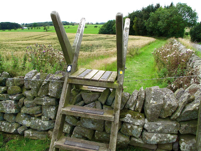
Being a national trail, the path was well marked. When in doubt on a national trail, one need only follow the white acorn, which is always posted on signposts, stiles, kissing gates, and other places along the path.
After crossing the road in the above photo, I continued westward past magnificent wheat and barley fields, all crowned with magical clouds.
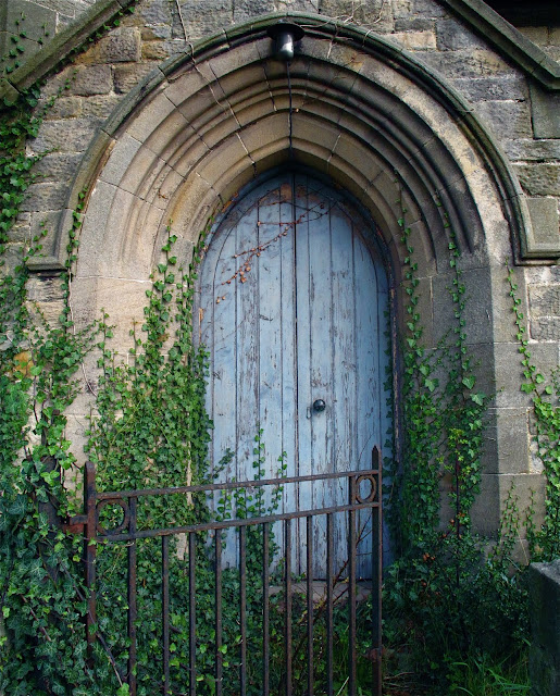
Passing through small villages, I discovered lovely old church doors . . .
. . . colorful barns . . .
. . . and stunning landscapes . . .
As I moved westward, the path was bracketed by endless bouquets of wildflowers on the left and a stone wall on the right . . .
. . . eventually leading me to cross the road, walk through a pasture of grazing cows . . .
. . . and discover a wonderful new section of the wall.
A few miles later, I arrived at the village of Wall, where I spent my second evening of the walk at the Hadrian Hotel. Little did I know that another guest in the hotel that night was the mysterious Solitary Walker . . .
Stay tuned. The scenery and the stories get better in the next post.
Stay tuned. The scenery and the stories get better in the next post.


